///landing page news/// #block-yui_3_17_2_1_1536639060504_25542
LANDING PAGE SIDE TRAY NEWS


////landing page image gallery side tray//// #block-yui_3_17_2_1_1536637953026_23981


/////instagram block///// #block-yui_3_17_2_1_1535342068001_5757


///// projects page ///// #block-yui_3_17_2_1_1537826673393_13235


//carousel of important or featured updates /// #block-yui_3_17_2_1_1535230893862_10524


//archive of all content in updates blog//// #block-yui_3_17_2_1_1535230893862_4873
-
January 2025
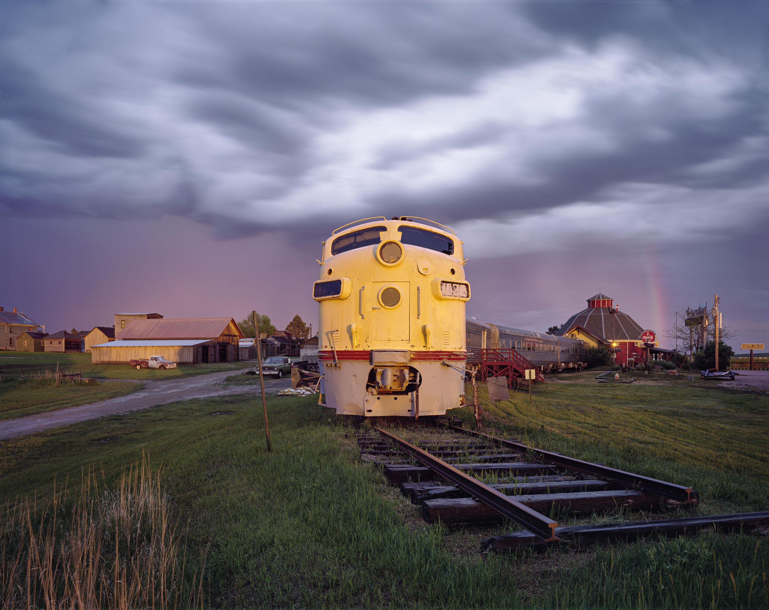
- Jan 8, 2025 Ep. #51: The American Scene: John Sanderson’s Journey through American Landscapes Jan 8, 2025
-
September 2024
- Sep 23, 2024 The Grove, Zatara Press Sep 23, 2024
-
November 2023
- Nov 1, 2023 National Character, Galerie ChaShaMa, New York City Nov 1, 2023
-
August 2023
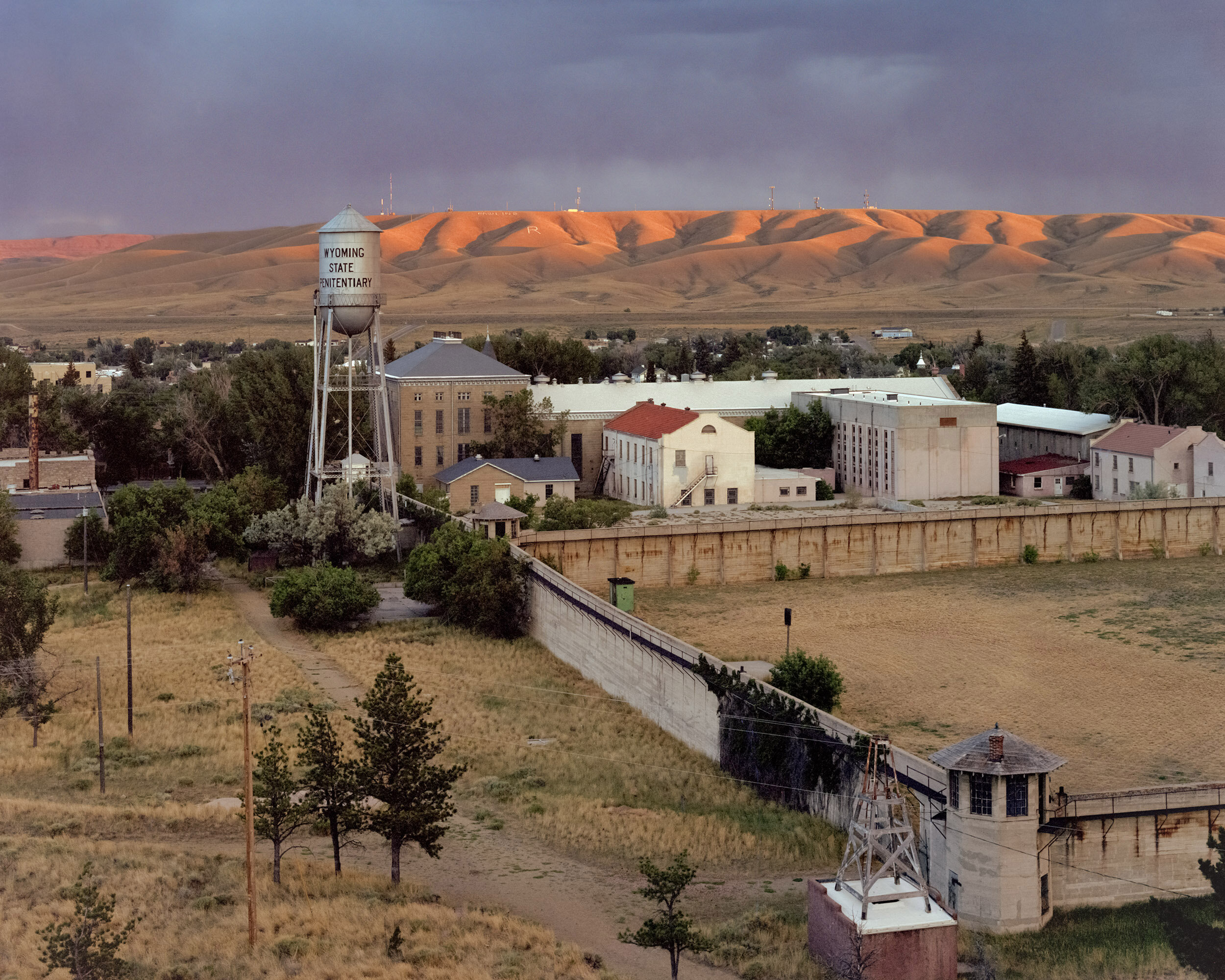
- Aug 31, 2023 Der Greif Magazine: Carbon County Q&A with John Sanderson Aug 31, 2023
-
May 2023
- May 9, 2023 Railroad Landscapes, Revela't Festival, Vilassar de Dalt, BCN, 2023 May 9, 2023
-
October 2022
- Oct 24, 2022 Carbon County Folio Box and Booklet, Zatara Press Oct 24, 2022
-
August 2022
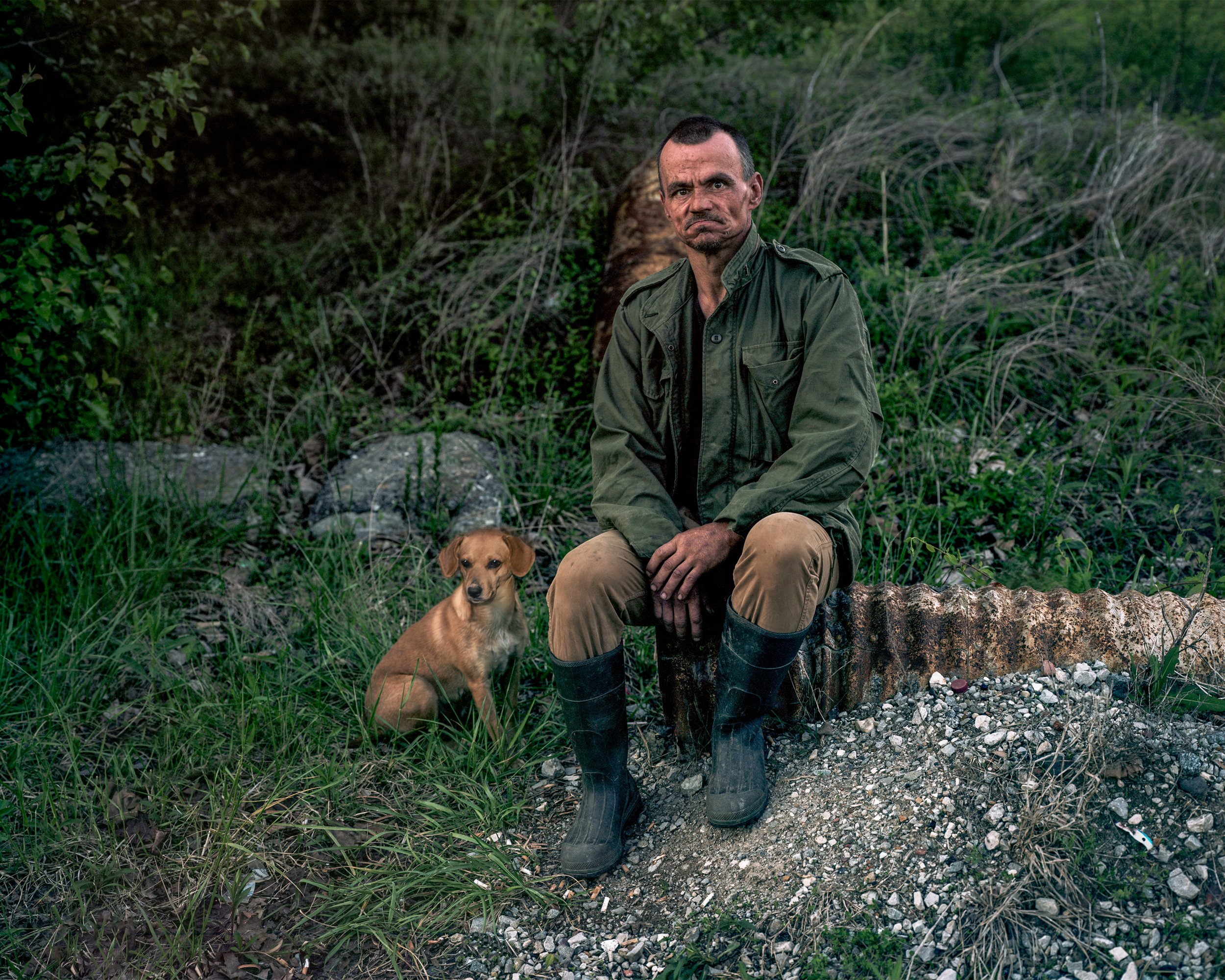
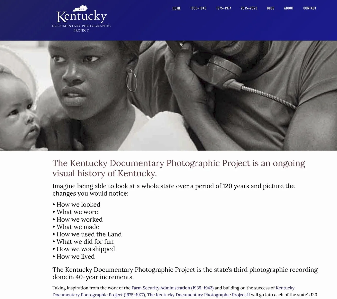
- Aug 11, 2022 Commission, Kentucky Documentary Photography Project, 2022 Aug 11, 2022
- Aug 11, 2022 Yes, And: A survey exhibition of artists connected to Staten Island, Staten Island Museum, 2022-2023 Aug 11, 2022
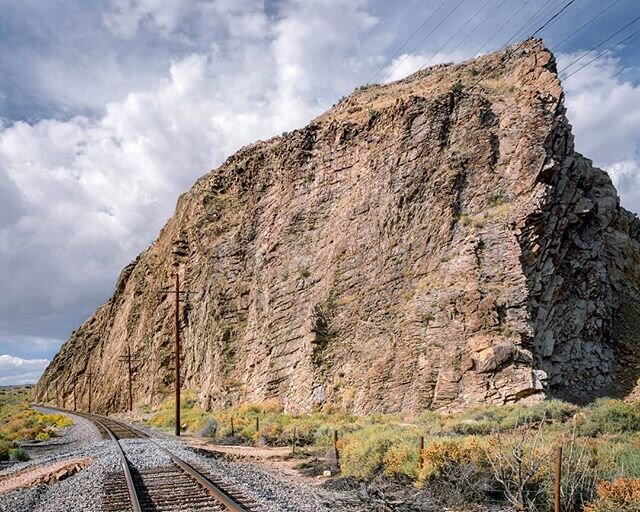
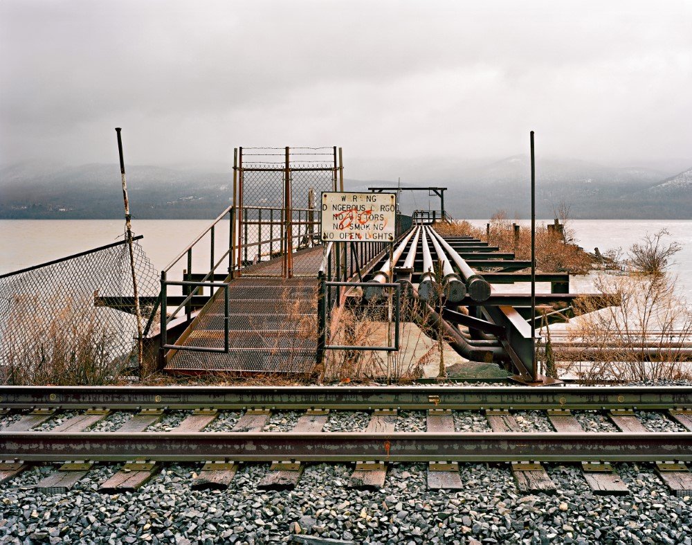
- Aug 11, 2022 Railroad Landscapes Presentation, Center for Railroad Art Aug 11, 2022
-
March 2022
- Mar 17, 2022 Along the Railroad Tracks, a Forgotten Landscape, FeatureShoot Mar 17, 2022
-
February 2022
- Feb 10, 2022 Investigations in Infrastructure, Subjectively, Objective Feb 10, 2022
- Feb 10, 2022 Everything is Narrative, Subjectively, Objective Feb 10, 2022
- Feb 10, 2022 The Railroad and The Art of Place, Center for Railroad Art Feb 10, 2022
-
October 2021
- Oct 6, 2021 Time Between Trains: Photographs by John Sanderson, The Master Gallery, 2022 Oct 6, 2021
-
October 2020
- Oct 8, 2020 Ron Rash, Serena, Éditions Gallimard (Cover) Oct 8, 2020
-
July 2020
- Jul 14, 2020 Magnetic West: The Enduring Allure of the American West Jul 14, 2020
- Jul 2, 2020 Magnetic West Virtual Artist Talk, Figge Art Museum Jul 2, 2020
-
June 2020
- Jun 14, 2020 Magnetic West: The Enduring Allure of the American West, Souix City Art Center, Souix City, Iowa, 2021 Jun 14, 2020
- Jun 13, 2020 Magnetic West: The Enduring Allure of the American West, Figge Art Museum, Davenport, Iowa, 2020 Jun 13, 2020
-
February 2020
- Feb 10, 2020 The Road, JKC Gallery, Trenton, New Jersey, 2020 Feb 10, 2020
- Feb 7, 2020 John Sanderson Interview | Carbon County – Episode 109, The Real Photo Show Feb 7, 2020
-
August 2019
- Aug 29, 2019 Rust Belt Biennial, Sordoni Gallery, Wilkes Barre, Pennsylvania, 2019 Aug 29, 2019
- Aug 19, 2019 Interview with John Sanderson, FLOAT Magazine Aug 19, 2019
-
June 2019
- Jun 25, 2019 John Sanderson: Carbon County, Lenscratch Jun 25, 2019
- Jun 10, 2019 John Sanderson: Why Large Format Film is Essential to My Work, Photo District News Jun 10, 2019
-
April 2019
- Apr 5, 2019 Carbon County Folio Box and Booklet by John Sanderson, Kickstarter Apr 5, 2019
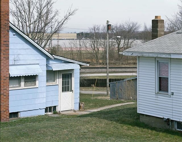
- Apr 1, 2019 Observations in the Ordinary, Subjectively, Objective Apr 1, 2019
-
March 2019
- Mar 29, 2019 After Promontory: 150 Years of Transcontinental Railroading, Indiana University Press Mar 29, 2019
- Mar 25, 2019 After Promontory: 150 Years of Transcontinental Railroading, BYU Art Museum, Provo, Utah, 2019 Mar 25, 2019
-
January 2019
- Jan 17, 2019 Trackside Interview #6 John Sanderson, The Trackside Photographer Jan 17, 2019
- November 2018
-
October 2018
- Oct 21, 2018 100 Photographers Review, CENTER Santa Fe Oct 21, 2018
- Oct 18, 2018 Negative Space III Exhibition, Brooklyn Grain, New York City, 2018 Oct 18, 2018
-
September 2018
- Sep 13, 2018 The Vernacular of Landscape at Usagi Gallery, L'Oeil de la Photographie Sep 13, 2018
- Sep 10, 2018 The Vernacular of Landscape Exhibition, Usagi Gallery, Brooklyn, NY, 2018 Sep 10, 2018
- Sep 8, 2018 The Vernacular of Landscape: Conversation Between Dana Stirling & Noah Waldeck Sep 8, 2018
-
July 2018
- Jul 6, 2018 The Vernacular of Landscape, FLOAT Magazine Jul 6, 2018
- Jul 6, 2018 The Vernacular of Landscape, Subjectively, Objective Jul 6, 2018
-
June 2018
- Jun 7, 2018 So Far Exhibition, Landskrona Festival, 2018 Jun 7, 2018
- Jun 1, 2018 American Splendour: New Photography, Ilon Art Gallery, 2018 Jun 1, 2018
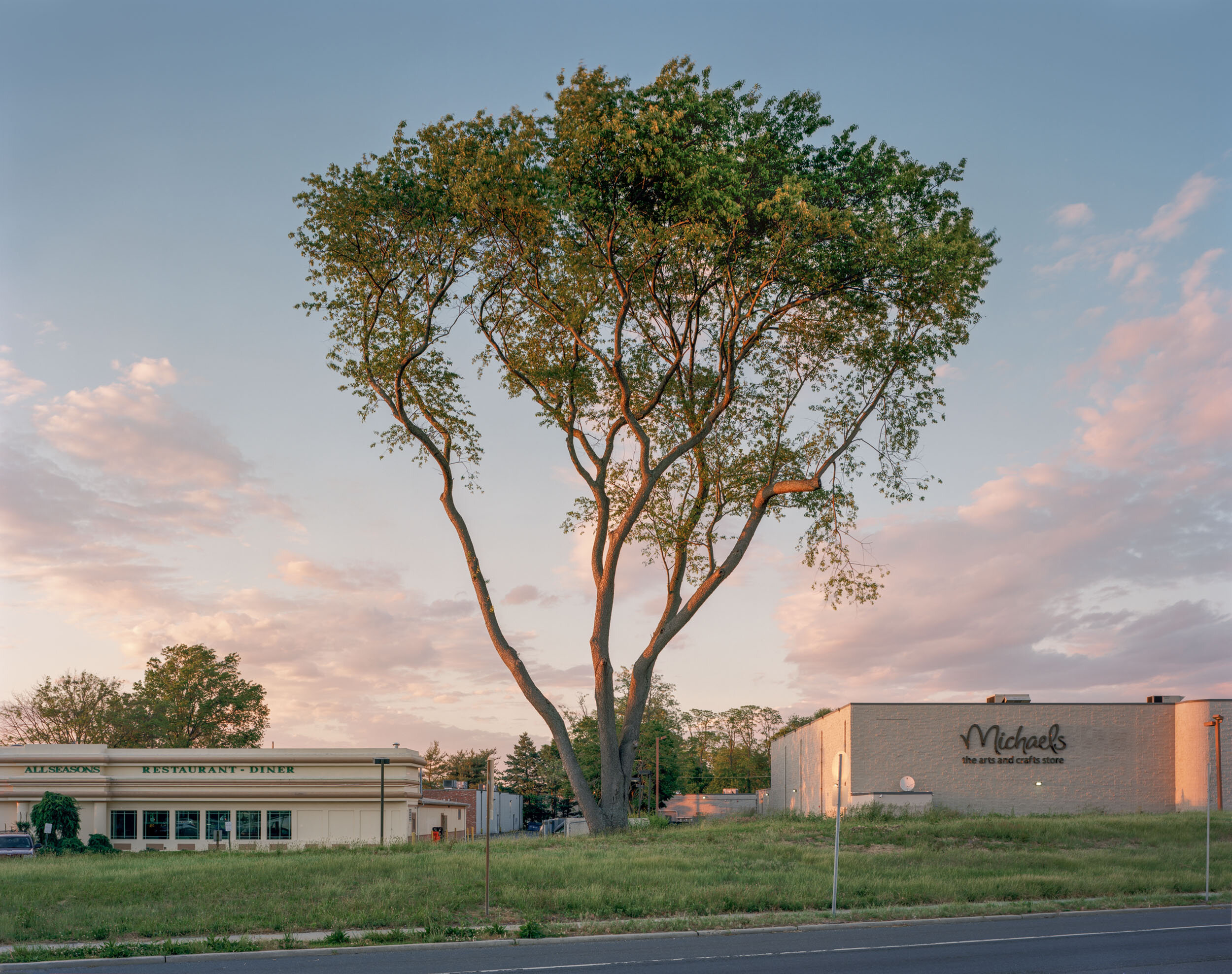
- Jun 1, 2018 Where is my American Splendour? Photography Exhibition Presents Hopeful View of American Politics and Culture Jun 1, 2018
-
May 2018
- May 18, 2018 The change of America in the stunning photos of John Sanderson, C 41 Magazine May 18, 2018
-
December 2017
- Dec 19, 2017 Issue 4 - John Sanderson: National Character Monograph, Subjectively, Objective Dec 19, 2017
-
September 2017
- Sep 8, 2017 Surprisingly beautiful pictures of America's empty railroads, Love Exploring Sep 8, 2017
-
July 2017
- Jul 31, 2017 Railways of America, Mirror UK Jul 31, 2017
- Jul 25, 2017 7 Train: Minutes to Midtown, New York Transit Museum, Grand Central Terminal Gallery Annex, 2017 Jul 25, 2017
- Jul 6, 2017 Highway Arbor, New Landscape Photography Jul 6, 2017
-
June 2017
- Jun 27, 2017 In pictures, The empty railways of America, BBC News Jun 27, 2017
- Jun 13, 2017 Landscape Bisected: American Railroads, A photo essay by John Sanderson, Terrain.Org Jun 13, 2017
-
May 2017
- May 30, 2017 In the Mind’s Eye: Working in Large Format by John Sanderson, Life Framer May 30, 2017
-
April 2017
- Apr 22, 2017 National Character by John Sanderson, The Artbo Apr 22, 2017
- Apr 4, 2017 Life Framer Awards International Exhibitions, 2017 Apr 4, 2017
-
March 2017
- Mar 26, 2017 Eyes on the South: The Counterpoint, Oxford American Magazine Mar 26, 2017
-
February 2017
- Feb 9, 2017 Urban Life Winner, Life Framer Awards Feb 9, 2017
- Feb 7, 2017 J.B. Jackson and the Railroad Landscape, Railroad Heritage, Winter 2017 Feb 7, 2017
-
January 2017
- Jan 31, 2017 On the Rails, The Plus Paper Jan 31, 2017
- Jan 16, 2017 Still Life Winner, Life Framer Awards Jan 16, 2017
-
December 2016
- Dec 16, 2016 ART NOW, New Directions in Contemporary Photography, PULP Magazine Dec 16, 2016
- Dec 10, 2016 John Sanderson, American Traditions + Railroad Landscape, L’Oeil de la Photographie Dec 10, 2016
-
November 2016
- Nov 15, 2016 Youthhood Winner, Life Framer Awards Nov 15, 2016
- Nov 5, 2016 Photographing Locomotives of a Bygone Era in America, Huffington Post Greece Nov 5, 2016
- Nov 3, 2016 Art on the Tracks: Teens Explore the End of the Line Exhibition, New York Transit Museum, Brooklyn, NY Nov 3, 2016
-
October 2016
- Oct 28, 2016 Group show 50, ‘Roid Rage, Humble Arts Foundation Oct 28, 2016
-
September 2016
- Sep 19, 2016 Interview and Gallery, LOOSENART Sep 19, 2016
- Sep 8, 2016 Man in the Landscape - Juror's Choice Award, PhotoPlace Gallery, 2016 Sep 8, 2016
-
August 2016
- Aug 22, 2016 International Print Exhibition, Royal Photographic Society, 2016 Aug 22, 2016
- Aug 5, 2016 Imagined Realities, PhotoPlace Gallery, 2016 Aug 5, 2016
- Aug 1, 2016 Winners, The Photo Review Competition Issue Aug 1, 2016
-
July 2016
- Jul 7, 2016 WE: Americans, Station Independent Projects, New York, NY, 2016 Jul 7, 2016
-
June 2016
- Jun 22, 2016 Obscura Land Volume 2, Subjectively Objective Jun 22, 2016
- Jun 16, 2016 Group show 49, I Love Kanye, Humble Arts Foundation Jun 16, 2016
-
May 2016
- May 7, 2016 Art on the Tracks: Teens Photograph The End of the Line, New York Transit Museum, Brooklyn, NY May 7, 2016
-
April 2016
- Apr 25, 2016 Dada Lives!, University of Cincinnati, Blue Ash, OH, 2016 Apr 25, 2016
- Apr 9, 2016 Guest Speaker, Center for Railroad Photography & Art Annual Conference Apr 9, 2016
- Apr 9, 2016 CRPA Exhibition: Railroad Landscapes, Glen Rowan House, Lake Forest College, Ill, 2016 Apr 9, 2016
- Apr 7, 2016 Abstract, figurative photos at Ann Arbor Art Center, Detroit News Apr 7, 2016
- Apr 1, 2016 Art Now: New Directions in Contemporary Photography - Best in Show - Ann Arbor Art Center, Ann Arbor, MI, 2016 Apr 1, 2016
-
March 2016
- Mar 26, 2016 John Sanderson, American Traditions, iGNANT Magazine Mar 26, 2016
-
December 2015
- Dec 15, 2015 Art on the Tracks: Teens Photograph Forgotten Railways Exhibition, New York Transit Museum, Brooklyn, NY Dec 15, 2015
-
November 2015
- Nov 15, 2015 Art on the Tracks: Teens Photograph Forgotten Railways, New York Transit Museum, Brooklyn, NY Nov 15, 2015
-
August 2015
- Aug 9, 2015 American Traditions, Ain’t Bad Magazine Aug 9, 2015
-
June 2015
- Jun 1, 2015 Artist-in-Residence, Brush Creek Ranch, Wyoming Jun 1, 2015
- Jun 1, 2015 Railroad Landscape Photography, New York City to Brush Creek, Kickstarter Jun 1, 2015
-
May 2015
- May 21, 2015 Issue 74, The Seventh Anniversary Issue, Fraction Magazine May 21, 2015
- May 8, 2015 Riding the Rails, Without Seeing a Train, The Wall Street Journal May 8, 2015
-
April 2015
- Apr 10, 2015 Center for Railroad Photography & Art Docent Scholarship Program, Lake Forest College, Ill, 2015 Apr 10, 2015
-
March 2015
- Mar 19, 2015 Un treno chiamato desiderio, Il Post Mar 19, 2015
-
February 2015
- Feb 9, 2015 The Hidden Beauty of American Train Travel, SLATE Magazine Feb 9, 2015
-
January 2015
- Jan 26, 2015 Beautiful Lonely Railroads Winding Through America’s Landscape, Gizmodo Magazine Jan 26, 2015
- Jan 19, 2015 Top 10 Photo Events in New York, Feature Shoot Jan 19, 2015
- Jan 15, 2015 John Sanderson, All About Photo Jan 15, 2015
- Jan 1, 2015 Stars & Stripes: The American Flag in Contemporary Art Jan 1, 2015
-
October 2014
- Oct 29, 2014 All Aboard! Railroads & The Historic Landscapes They Travel, Monmouth Museum, Lincroft, NJ, 2014 Oct 29, 2014
-
September 2014
- Sep 13, 2014 Railroad Landscapes Exhibition, New York Transit Museum, 2014-2016 Sep 13, 2014
- Sep 8, 2014 Beautiful Photos of Railroad Landscapes Coming to Transit Museum, Brooklyn Magazine Sep 8, 2014
- Sep 7, 2014 John Sanderson, Railroad Landscapes, New York Transit Museum, NBC News Sep 7, 2014
-
August 2014
- Aug 29, 2014 These Photos Will Make You Pine For Long Train Rides On The MTA, Gothamist Aug 29, 2014
-
June 2014
- Jun 18, 2014 The Shop Jun 18, 2014
-
November 2013
- Nov 18, 2013 Railroad Landscapes, New Landscape Photography Nov 18, 2013
- Nov 16, 2013 Railroad Landscapes, The Documentary and Poetic, Ain’t Bad Magazine Nov 16, 2013
-
July 2013
- Jul 25, 2013 Beyond the train: One scholarship helps artist add Midwest rail art to his portfolio, TRAINS Magazine Jul 25, 2013
-
June 2013
- Jun 14, 2013 Artist’s Talk, United Nations Plaza, Joy Wai Gallery, New York, NY Jun 14, 2013
-
April 2013
- Apr 12, 2013 Center for Railroad Photography & Art Docent Scholarship Program, Lake Forest College, Ill, 2013 Apr 12, 2013
-
November 2012
- Nov 17, 2012 Annual RxArt Auction, Milk Studios, New York, NY, 2012 Nov 17, 2012